
How to Read a US Travel Region: Understanding Climate Zones, Time Zones, and Entry Points
America's size means climate, time zones, and access vary enormously. Learn how geography shapes your travel experience before you plan.
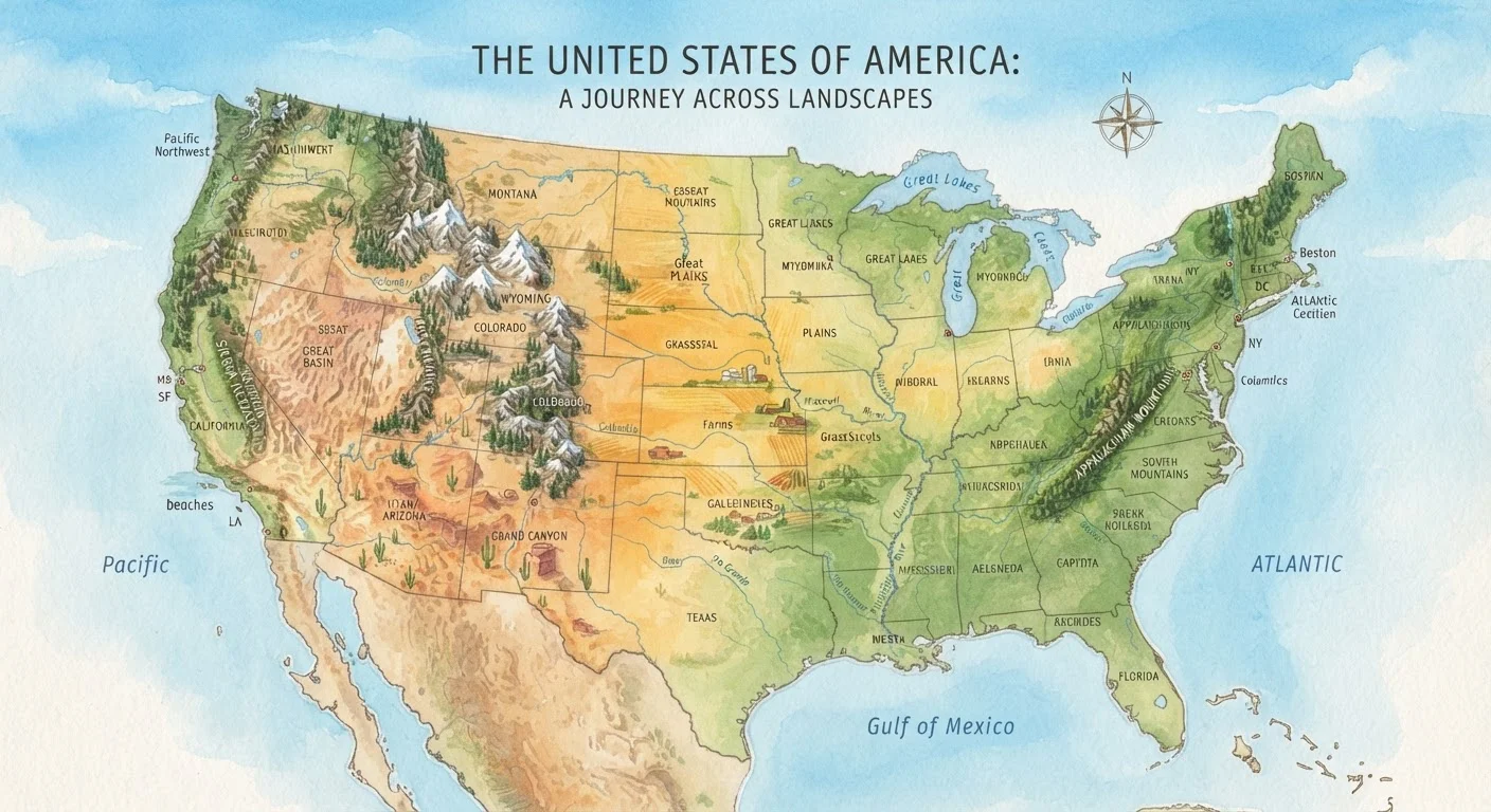
Photo: FaqsDrive.com | Smart Way To Search editorial
—— In This Article
Key Takeaways
- The contiguous US spans four time zones, which directly affects flight scheduling and daily activity planning.
- Climate zones range from Arctic tundra in Alaska to subtropical humidity in Florida — packing lists should reflect the region, not just the season.
- Major entry points — airports, land borders, interstate hubs — vary significantly by region and affect total trip cost and logistics.
- Understanding a region's geography before booking helps you avoid common planning mistakes like under-packing or scheduling conflicts.
- Off-season timing in one climate zone can mean peak season in another — regional knowledge prevents surprises.
Why Regional Geography Matters Before You Book
Most travel mistakes don't happen at the destination — they happen at the planning stage. Americans often underestimate just how dramatically conditions shift across the country. Miami and Denver may both be domestic flights, but one is subtropical and sea-level while the other sits at over 5,000 feet with semi-arid mountain air. Knowing how to read a travel region means understanding what kind of environment you're actually entering, not just where it appears on a map.
Three building blocks shape every US travel region: its climate zone, its time zone position, and its primary entry points. Together, these three factors determine what to pack, when to go, and how to get there efficiently. Skipping this homework is a reliable way to end up underprepared — or significantly over-budget.
Alaska and Hawaii Are Their Own Story
Alaska and Hawaii don't fit neatly into continental US regional frameworks. Alaska spans multiple climate zones — from temperate rainforest in the southeast to Arctic tundra in the north — and sits in its own time zone. Hawaii has a tropical climate moderated by trade winds, with significant variation between the windward and leeward sides of each island. Both states require destination-specific research rather than general continental US assumptions.
Reading Climate Zones Across the US
NOAA identifies nine distinct climate regions in the contiguous United States, and Alaska adds polar and subarctic conditions on top of that. The Southeast is defined by heat and humidity that persists well past Labor Day. The Southwest bakes under arid desert conditions where summer highs routinely exceed 100°F. The Pacific Northwest deals in mild, wet winters and mild summers, while the Great Plains experience dramatic temperature swings and severe storms.
Climate zones also shift with elevation. In the Mountain West, a two-hour drive can take you from desert floor to alpine tundra. This is why checking a destination's elevation — not just its state or region name — matters enormously for packing and safety planning.
Seasonal overlap is another key concept. When the Northeast is locked in February cold, southern Arizona and coastal California are drawing visitors with mild, sunny weather. This mismatch between regional seasons is exactly why off-season travel strategies vary so much depending on where you're headed.
9
Distinct US climate regions (NOAA)
NOAA's official climate regions for the contiguous United States, each with distinct seasonal and precipitation patterns.
6
Standard US time zones
The US spans six standard time zones from Eastern to Hawaii-Aleutian, making cross-country scheduling more complex than many travelers expect.
3 hrs
Time difference, East to West Coast
A three-hour gap between Eastern and Pacific time zones affects flight scheduling, daily itineraries, and communication with local vendors.
Navigating Time Zones Like a Planner
The contiguous US alone spans four time zones — Eastern, Central, Mountain, and Pacific — with Alaska and Hawaii adding two more. That's a three-hour gap between New York and Los Angeles, which has real consequences. A 6 a.m. flight out of LAX is a brutal 9 a.m. Eastern wake-up call for a traveler arriving from the East Coast the night before. Meetings, tour bookings, and attraction opening hours are all listed in local time, not yours.
When planning multi-stop trips that cross time zones, build buffer time into your first day at each new location. Jet lag isn't limited to international travel — crossing three time zones within the US can disrupt sleep and energy levels, particularly for younger children or older travelers.
Time zones also affect the practical logistics of calling hotels, rental car companies, or national park visitor centers. Calling a Utah park at 8 a.m. Eastern time means you're calling at 6 a.m. Mountain — before most offices open.
Set Your Phone Clock to Local Time Immediately
The moment you land in a new time zone, update your phone to local time and stop mentally converting back to home time. This simple habit helps your body adjust faster and prevents scheduling errors with tours, restaurants, and transportation. Most smartphones update automatically, but double-check if you're in a remote area with spotty signal.
Understanding Entry Points: Airports, Highways, and Rail
Every US travel region has a dominant entry infrastructure. The Northeast is served by a dense Amtrak corridor and several major hub airports. The South and Southeast rely heavily on Atlanta's Hartsfield-Jackson, which serves as a connecting hub for much of the region. The Mountain West is largely car-dependent once you land, with vast distances between destinations. The Pacific Coast offers direct international access through LAX, SFO, and Seattle-Tacoma.
Entry point choices affect your overall budget. Flying into a major hub often unlocks cheaper fares, but renting a car and driving several hours to your actual destination adds cost and time. Smaller regional airports sometimes offer more direct access to your destination even if the base fare is higher.
Understanding entry points is especially important for nature-focused travel. Planning a national parks trip often requires identifying the nearest gateway town and airport, then accounting for significant driving time on two-lane roads. Some parks have no nearby commercial airport at all.
For travelers deciding between very different regional types altogether, it helps to think through environment preferences first. See how coastal and mountain regions compare in terms of logistics and experience in our coastal vs. mountain getaway guide.
Frequently Asked Questions

Travel & Trips Editorial Team
Travel & Trips Editorial Team is the collective byline for our editorial team and contributor network. Articles published under this byline or an editorial pen name are researched, written, and reviewed according to our editorial standards for clarity, consistency, and independence before publication.
View author profile